
What Lies Beneath

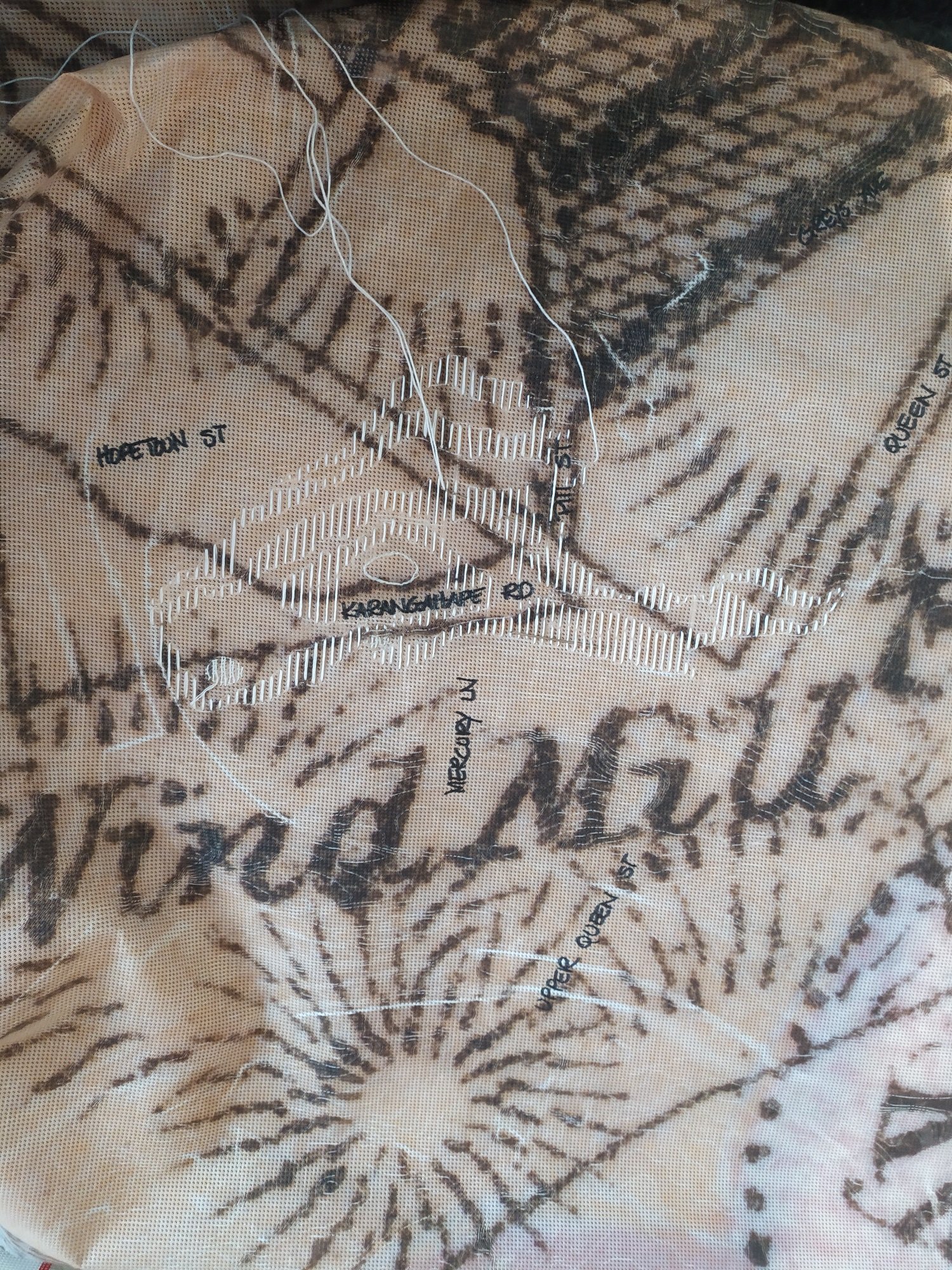
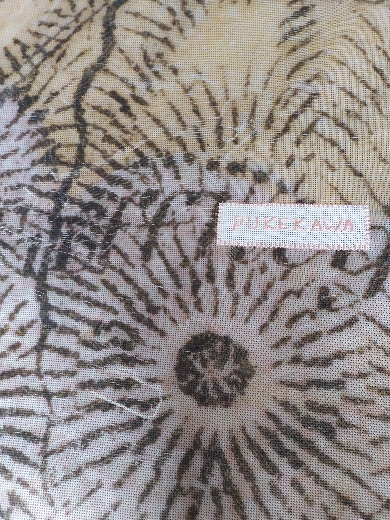
WIP: Uncovering the contours of the land from Karanga A Hape to Pukekawa heading east
The volcanoes of Tāmaki Makaurau originally shaped the region's landscape over the last 193,000 years. Ferdinand von Hochstetter drew the 362 km2 volcanic field in 1859. We've overlaid a current contour map and then 'mapped' on a few street names to help people orient themselves. This is the initial stage of an exploration of the Karangahape ridge.
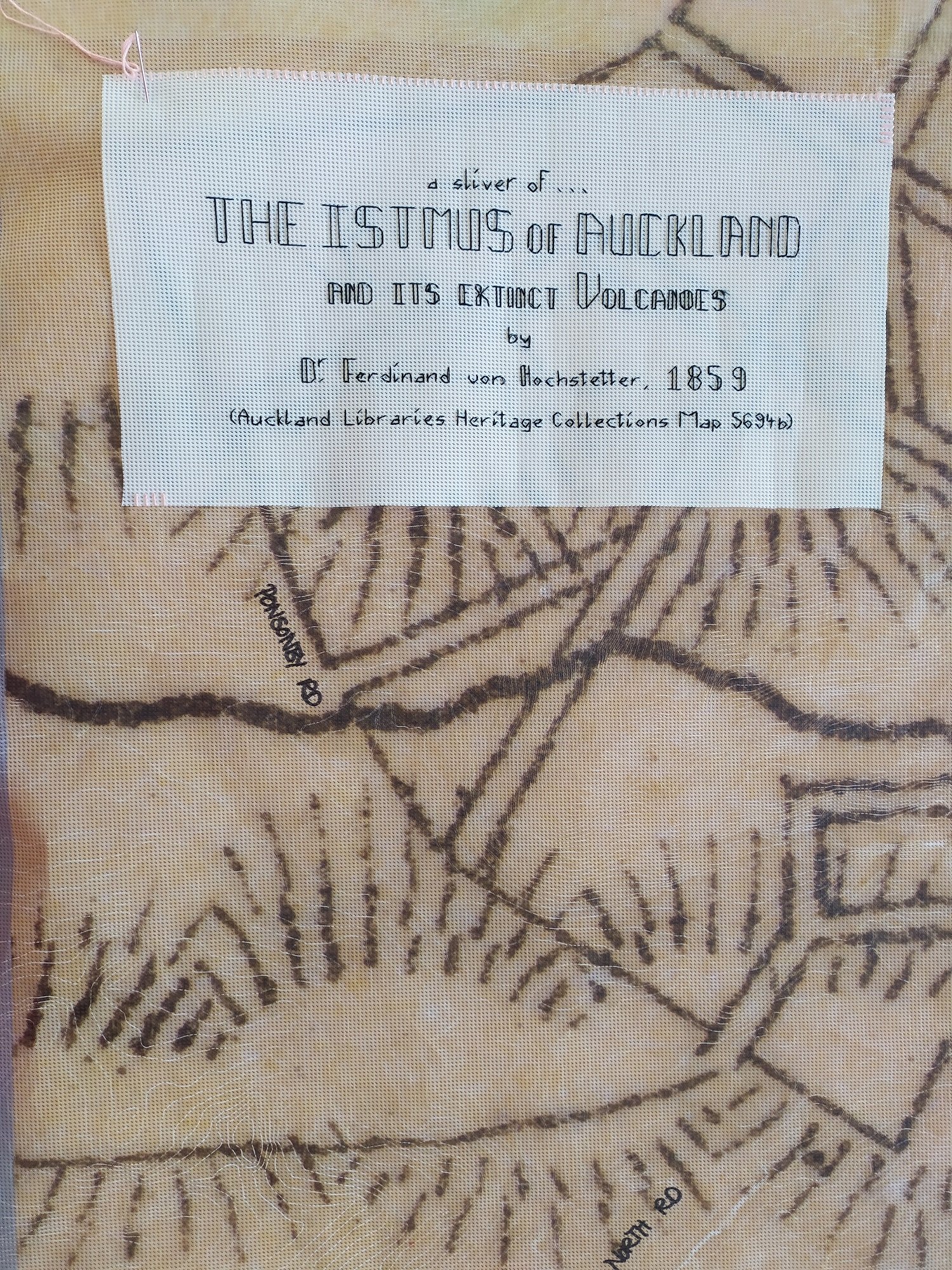
The original map is "The istmus of Auckland with its extinct volcanoes", by Dr Ferdinand von Hochstetter (1859 Auckland Library Heritage Collection Map 5694B) and overlaid Geomaps from Auckland Council to map the current landscape.
This work again invites people to consider both man and nature as designers and architects this time using the Karangahape ridge to explore Auckland’s past and present and invites people to ponder the future.
Work in progress
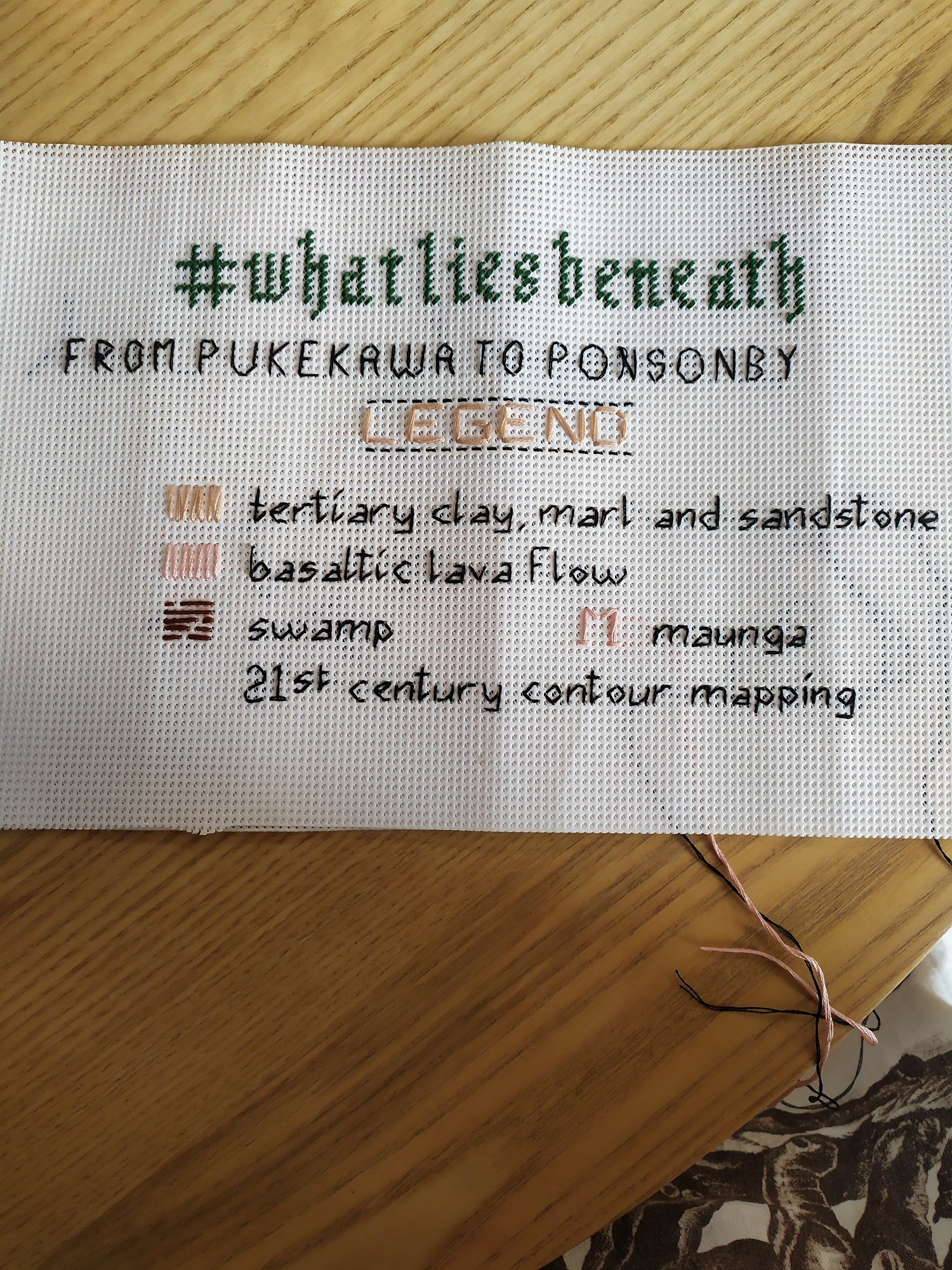
Technical Information:
Originally developed for 'Street Front' in Auckland, December 2020 and an on-going work.
Stitching on builders scrim
Measurement: 2100mm x 1500mm

WIP: the original canvas, with a sliver of Hochstetter’s map, overlaid with 21st century contour lines, handwritten 21st century street names (for orientation) and stitching to highlight the contours around the Karanga A Hape ridge yet to begin